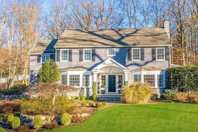
Ho-Ho-Kus
History
Ho-Ho-Kus is unique and special. With access to the 3 metropolitan airports, is dissected by route 17, has direct train & bus service to NYC, is a few minutes from the NY State Thruway, and has the Garden State Parkway in its backyard. However, the prime location and the transportation conveniences do not diminish or interfere with the serene, halcyon atmosphere evident throughout the town. It is residential in nature, has no major industries, but does have a number professional offices, attractive stores, & businesses. Its development began as a community in the 1700's when homes were built and farms were cultivated. As time progressed, and by 1725, one could find the existence of a church formed under the name "low Dutch Reformed Church" and due to the insistence of the sturdy Dutch influence, a school was started as well.
General Information
Town Name: Ho-Ho-Kus
City Hall: Ho-Ho-Kus Borough Hall
Address: 333 Warren Avenue, Ho-Ho-Kus NJ 07423
Phone Number: 201-652-4400
Land Area:Distance to NYC: 24 miles
Town Website: http://www.ho-ho-kusboro.com/
Library Website: http://www.bccls.org
Water Service: Borough Owned
Gas & Electric: P.S.E.&G.
Demographics
Population: 4,078
Population Density / Mile: 2,350
Median Age: 45.89
Number of Households: 1,401
Average Household Size: 2.91
Households with Children: 581
Median Household Income: $159,028
School Ratings
Mahwah

History
As the largest municipality in Bergen County, Mahwah has more open space than any other town in Bergen County. It has a wide range of housing including charming Cape Cods, stately historic homes, townhouse and condominium communities and million-dollar mansions. Mahwah has been able to keep its small town character while attracting commercial enterprises. Many large corporations such as Datascope, Jaguar, Stryker, Seiko, and UPS have chosen Mahwah as their corporate home. The bucolic campus of Ramapo College is also located in the Township.
General Information
Town Name: Mahwah
City Hall: Mahwah Township Hall
Address: 475 Corporate Drive, Mahwah NJ 07430
Phone Number: 201-529-5757
Land Area:Distance to NYC: 30 miles
Town Website: http://www.mahwahtwp.org
Library Website: http://www.bccls.org
Water Service: Township owned
Gas & Electric: P.S.E.&G./Rockland Electric
Demographics
Population: 26,756
Population Density / Mile: 1,040
Median Age: 41.14
Number of Households: 9,883
Average Household Size: 2.414
Households with Children: 2,562
Median Household Income: $109,717
School Ratings
Midland Park

History
Originally settled by the Dutch, this fine, moderately priced community has many quaint old colonial homes. It is within a short distance of major highways and within an easy commute to NYC. Midland Park is an involved community of young & old alike, providing year-round recreational facilities with especially interesting programs for people of all ages.
General Information
Town Name: Midland Park
City Hall: Midland Park Borough Hall
Address: 280 Godwin Avenue, Midland Park NJ 07432
Phone Number: 201-445-5720
Land Area:Distance to NYC: 15 miles
Town Website: https://www.midlandparknj.org/
Library Website: http://www.bccls.org
Water Service: Village of Ridgewood
Gas & Electric: P.S.E.&G.
Demographics
Population: 7,156
Population Density / Mile: 4,613
Median Age: 44.17
Number of Households: 2,767
Average Household Size: 2.585
Households with Children: 855
Median Household Income: $101,605
School Ratings
Montvale

History
Montvale is a small borough of approximately 4 square miles ideally situated in the picturesque Pascack Valley of northeastern Bergen County, bordering on New York State. The residents enjoy a high quality of life with fine schools and recreation programs, and easy access to area shopping and cultural activities. The new Municipal Complex houses a state of the art Library, hi-tech Police Station and new Borough Hall. There are many new developments being built in Montvale from townhouses, single-family homes to senior housing. The Borough is in the process of constructing a New Senior Center downtown. Montvale’s blend of corporate and residential areas make the Borough a unique suburban community with something to offer everyone.
General Information
Town Name: Montvale
City Hall: Montvale Borough Hall
Address: 12 Mercedes Drive, Montvale NJ 07645
Phone Number: 201-391-5700
Land Area: 4 miles
Distance to NYC: 32 miles
Town Website: https://www.montvale.org/
Library Website: http://www.bccls.org
Water Service: Hackensack Water Company
Gas & Electric: P.S.E. & G./Rockland Electric
Demographics
Population: 8,819
Population Density / Mile: 2,204
Median Age: 44.47
Number of Households: 3,129
Average Household Size: 2.818
Households with Children: 1,157
Median Household Income: $151,230
School Ratings
New Milford
History
The story of New Milford has been one of the Demarests and the Van Buskirks. David Demarest arrived in New Milford via the Hackensack River, encountered the Lenni Lenape Indians, and bought 8000 acres of land from them on June 8, 1677. They were the only family permanently in what now is Bergen County.
Next to the Van Steuben House is a good example of early Dutch architecture (the Demarest House) and it formerly stood next to the French cemetary in New Milford. It was originally owned by a Demarest, and moved to its present site in 1955.
In 1681 New Milford was surveyed and was owned by four Demarests. In the 18th century New Milford was basically farmland. Demarest Crossing was an important trading center and “seaport”. River Road is probably one of the oldest streets in Bergen County and one of the least changed. It was probably an old trappers trail. The next oldest streets are Henley and New Bridge Road.
New Milford was then in a period of quiet growth and became one of the fattest, most comfortable, and envied areas of the colonies.
In the 1770's New Milford was proud of its farmland of rich soil. There were a few small clusters of homes, gristmills, a sawmill, two or three taverns, and a Latin school.
The colonies followed a degree of self-government which they learned back in England. New Milford provided many Justices and Freeholders to help the County, and also representatives in the Provincial Assembly. Justices of the Peace were main figures in local government, having administrative as well as judicial authority. They appointed tax collectors and tax assessors and seized properties of those who did not pay their taxes. They built jails and filled them. The Freeholders were elected to consult with justices, particularly in the matter of levying taxes for roads.
Wheat was their principal crop along with buckwheat and corn. Cabbage was grown for sauerkraut and as fodder for cattle and hogs. Wild hemp grew hardily in the woods and was used for rope, hats, baskets, mats, wall covering and roofing. Flax tobacco and watermelon also grew in hardy crops.
During the 1700's there was a strong slavery economy. In 1726 there were approximately 2000 whites and 500 blacks in Bergen County.
New Milford is rich with history of the revolution, including George Washington and the troops at the New Bridge Inn (built about 1739), which was the center of the action. Within New Milford there was also a civil war where families were split apart. The attitude was one of wishful hoping that the trouble would pass away without disturbing the serenity of the valley.
Throughout the war, New Milford continued to bear the brunt of attack due to the strategic nature of New Bridge. Control of the area volleyed back and forth until the end of the war.
In the 19th century life remained tranquil and predominantly farmland. The Hackensack River was used to distribute the produce downstream. Industry in the area began with the local blacksmiths. There were five from New Bridge to old New Milford streets.
In 1830 there was a pottery mill on the Hackensack River spawned by the rich red clay at the banks. A collection of the pottery is on display at the Van Steuben House.
Wampum was used for trade with the Indians and was made in the 1840's in New Milford by Mary Jane Bell, who specialized in making black wampum beads derived from ocean clamshells. White wampum was made from conch shells.
Amusements were simple during this time. Farmers were “early to bed, early to rise”, but an interest in politics remained lively, leading back to the early days of the revolution. Elections were held in rotations at Tenafly, Cresskill, Schraalenburg (Dumont and Bergenfield) and Peetsburgh (New Milford). Elections were considered holidays permitting the citizenry to travel afoot or by carriage to the polling places. Many neighborhood disputes arose.
The Hackensack River was a scene of continuous activity until the end of the 19th century. At that time the NJ and NY Railroads became the primary means of commercial transportation.
From the days of the Indians, the Hackensack River provided amateur fishing for locals. Commercial fishing followed with the introduction of the railroad.
During the Civil War years, prevailing opinion in New Jersey as a whole, and Bergen County in particular, was unsympathetic to the Union cause. The reason was that the inhabitants were still predominately of Dutch heritage. Their prime consideration was the orderly conduct of their farms, for which domestic peace was essential. During the Civil War many of these conservatives tried to maintain their orderly lives by staying neutral. In addition, slavery as an institution was dying out in New Jersey. Only slaves born prior to 1804 were legally owned and at the time of the Civil War the youngest slave had to be fifty-seven years old. The farm owners considered themselves kind masters and worked side by side in the fields with their slaves who enjoyed more freedom than that of slaves in the south.
Elsewhere in the State, men of different ancestry such as railroading and manufacturing shared the southern point of view of States Rights. A group of 939 volunteers made up the regiment from the agriculture population of Bergen County. Elections thereafter shifted frequently between parties. After the Battle of Bull Run in July 1861 peace meetings began to be held in Bergen County. The State and Bergen County in particular voted against Lincoln by large margins in both of his elections.
In 1692 the Colonial Assembly divided Bergen County into two Townships, Hackensack and New Barbados. In 1871 Hackensack was divided into three smaller townships called Ridgefield, Englewood, and Palisades.
The Township of Palisades included New Milford, Dumont, Bergenfield, Cresskill, Tenafly and a part of both Demarest and Oradell.
Toward the end of the 19th Century inhabitants of many townships became dissatisfied with the management of their taxes and redistricting of schools. In 1893 school classes in New Milford were held in one room at the firehouse on Center Street in Peetzburg as it was called then. Pupils also attended school in Teaneck and Oradell. As a result a number of political subdivisions emerged.
The first to secede from Palisades Township was Tenafly in 1894, and Palisades no longer had its eastern boundaries on the Hudson River hence the historic name. By 1900, Bergenfield, Dumont and Cresskill, all dissatisfied with the larger township’s handling of local affairs, had broken away. All that remained of Palisades Township at that point was what we now know as New Milford.
At the close of the 19th century, the name New Milford had practically vanished on both sides of the Hackensack River. Not until voters from New Bridge, north to Oradell and east to Dumont and Bergenfield, combined to form a new Borough, was the old name reactivated by referendum.
On April 18, 1922 the Borough of New Milford was incorporated.
General Information
Town Name: New Milford
City Hall: New Milford Borough Hall
Address: 930 River Road, New Milford NJ 07646
Phone Number: 201-967-5044
Distance to NYC: 18 miles
Town Website: http://www.newmilfordboro.com/
Library Website: http://www.bccls.org
Water Service: United Water Company
Gas & Electric: P.S.E.&G.
Demographics
Population: 17,503
Population Density / Mile: 7,714
Median Age: 42.92
Number of Households: 6,479
Average Household Size: 2.665
Households with Children: 1,793
Median Household Income: $87,824
School Ratings
Northvale
History
Northvale's early history can be placed back to Henry Hudson, who explored the area from the New York Harbor up the palisades. All of the land in the borough of Northvale was bought from the local Leni-Lenape Indians in 1681. In 1887, Northvale, then known as "Neuwy" was described as a quiet town of 400, mostly French & Italians, who conducted quite an extensive business in the manufacture of materials for artificial flowers. In May of 1916, when Northvale officially became a borough of Bergen County, it had a population of 827 and the highest tax rate in the County.
General Information
Town Name: Northvale
City Hall: Northvale Borough Hall
Address: 116 Paris Avenue, Northvale NJ 07647
Phone Number: 201-767-3330
Distance to NYC: 25 miles
Town Website: http://www.boroughofnorthvale.com/
Library Website: http://www.bccls.org
Water Service: Hackensack Water Company
Gas & Electric: P.S.E.&G./Rockland Electric
Demographics
Population: 4,986
Population Density / Mile: 3,860
Median Age: 45.62
Number of Households: 1,662
Average Household Size: 2.964
Households with Children: 568
Median Household Income: $93,212
School Ratings
Norwood
History
Norwood, consisting of 2.75 square miles, borders Northvale to the north, Harrington Park to the west, Alpine to the east, and Closter to the south. It is part of the historic grounds of Old Harrington Township and succeeded from the parent township in March, 1905, and was organized.
General Information
Town Name: Norwood
City Hall: Norwood Borough Hall
Address: 455 Broadway, Norwood NJ 07648
Phone Number: 201-767-7200
Land Area: 2.7 square miles
Distance to NYC: 15 miles
Town Website: http://www.norwoodboro.org/
Library Website: http://www.bccls.org
Water Service: United Water Company
Gas & Electric: P.S.E.& G./Rockland Electric
Demographics
Population: 5,952
Population Density / Mile: 2,167
Median Age: 48.89
Number of Households: 2,003
Average Household Size: 2.854
Households with Children: 591
Median Household Income: $113,342
School Ratings
Oakland
History
As you drive west along Route 208/287 approaching the Ramapo River, it is hard to imagine that 300 years ago this interstate highway may have been a quiet tree-lined path in a little valley used by the Minsi Indians of the Lenni Lenape tribe. The first Dutch settlers, who were stopped by the Ramapo River at the end of the path that is now Franklin Avenue, became so enamored of the area that they bought some 5,500 acres of it. The Minsi enjoyed these fertile valleys, hunted in the woods and fished in the "Ramapaugh" or "river of many round ponds". Thus, the Dutch called their settlement "De Panne" or the "The Ponds". Throughout the 18th century, Oakland evolved into a serene farming and lumbering area with numerous mills powered by the waters of the Ramapo River and numerous streams. In 1870 the town's name was changed from "The Ponds" to Oakland. After World War II, Oakland began its rapid development of permanent residents as commuting time to work became less and country living became more desirable. In the 1950's, Oakland was a non-farm community earning its title as “The Valley of Homes”.
General Information
Town Name: Oakland
City Hall: Oakland Borough Hall
Address: Municipal Plaza, Oakland NJ 07436
Phone Number: 201-337-8111
Land Area: 8.6 square miles
Distance to NYC: 28 miles
Town Website: http://www.oakland-nj.org/
Library Website: http://www.bccls.org
Water Service: Borough owned
Gas & Electric: P.S.E.&G./Rockland Electric
Demographics
Population: 12,727
Population Density / Mile: 1,505
Median Age: 45.66
Number of Households: 4,320
Average Household Size: 2.898
Households with Children: 1,726
Median Household Income: $115,525
School Ratings
Old Tappan
History
The Delaware Indian word "Tuphanne" is where the name Tappan is derived from. It means cold water. Why it was named Old Tappan, no one knows, but it is believed that it was to distinguish it from Tappan, New York, of which Old Tappan was formerly a part. In 1704, Cosyn Haring, one of the original 16 parents, obtained a land grant from Queen Anne of England for most of the land which is now Old Tappan.
General Information
Town Name: Old Tappan
City Hall: Old Tappan Borough Hall
Address: 227 Old Tappan Road, Old Tappan NJ 07675
Phone Number: 201-664-1849
Land Area: 3.9 square miles
Distance to NYC: 12 miles
Town Website: http://www.oldtappan.net
Library Website: http://www.bccls.org
Water Service: United Water Company
Gas & Electric: P.S.E. & G./Rockland Electric
Demographics
Population: 5,735
Population Density / Mile: 1,730
Median Age: 46.72
Number of Households: 1,929
Average Household Size: 2.973
Households with Children: 663
Median Household Income: $134,359
School Ratings
Oradell
History
This borough of about 8,000 people snuggled up against the Oradell Reservoir, on the Hackensack River, between Emerson & New Milford, was incorporated in 1894 as Delford, New Jersey. It was Daniel Demarest, Oradell's second mayor, who is credited with giving the community its present name.
General Information
Town Name: Oradell
City Hall: Oradell Borough Hall
Address: 355 Kinderkamack Road, Oradell NJ 07649
Phone Number: 201-261-8200
Land Area: 2.4 square miles
Distance to NYC: 15 miles
Town Website: http://www.oradell.org/
Library Website: http://www.bccls.org
Water Service: United Water Company
Gas & Electric: P.S.E.&G.
Demographics
Population: 8,112
Population Density / Mile: 3,346
Median Age: 46.58
Number of Households: 2,791
Average Household Size: 2.872
Households with Children: 1,160
Median Household Income: $144,798
School Ratings
Paramus
History
On April 4, 1922, the Borough was incorporated. It is a residential community and a retail center for the surrounding region. Located here are several large retail shopping malls and a community college. Paramus occupies 10.573 square miles, 6,767 acres. It is the second largest among 70 municipalities in Bergen County.
General Information
Town Name: Paramus
City Hall: Paramus Borough Hall
Address: 1 Jockish Square, Paramus NJ 07652
Phone Number: 201-265-2100
Distance to NYC: 15 miles
Town Website: http://www.paramusborough.org
Library Website: http://www.bccls.org
Gas & Electric: P.S.E.&G.
Demographics
Population: 27,214
Population Density / Mile: 2,596
Median Age: 47.99
Number of Households: 8,933
Average Household Size: 2.917
Households with Children: 2,888
Median Household Income: $106,004
School Ratings
Park Ridge

History
Park Ridge taxes have stabilized over the past 7 years and with the residential (single family), townhouse (120 units in bears nest village), and an assisted living care facility planned for construction in the next 2-4 years, taxes should remain stable for some years to come. In 1991, Park Ridge had the 44 lowest effective tax rate in Bergen county; In 1996 the borough had jumped 25 places and now has the 19th lowest effective rate in Bergen County. Park Ridge operates its own electric utility and residents enjoy the lowest electric rates in New Jersey. Park Ridge also has its own water utility. Water rates are 20% lower than the rates charged by United Water Resources. Park Ridge operates a K-12 school system with about 1100 students. There are two elementary schools (K-6) with 600 students, and a Junior/Senior High School (7-12) with 500 students. In 1992, Park Ridge was rated in the top 10% of public high schools in New Jersey based on S.A.T. scores and attendance at the nation's best colleges.
General Information
Town Name: Park Ridge
City Hall: Park Ridge Borough Hall
Address: 55 Park Avenue, Park Ridge NJ 07656
Phone Number: 201-573-1800
Land Area:Distance to NYC: 25 miles
Town Website: http://www.parkridgeboro.com/
Library Website: http://www.bccls.org
Water Service: Park Ridge Water Utility
Gas & Electric: P.S.E. & G./Park Ridge Electric
Demographics
Population: 8,698
Population Density / Mile: 3,361
Median Age: 47.53
Number of Households: 3,308
Average Household Size: 2.566
Households with Children: 1,156
Median Household Income: $105,559
School Ratings
Ramsey
History
This attractive community has an appearance of pastoral serenity, yet is vital and modern in every respect. Splendid recreational facilities such as swimming, tennis, junior football, soccer, and baseball for both boys & girls form a cornerstone of this fine community. Ramsey's school system, which includes a four year high school, does an outstanding job of preparing youths for future endeavors. It is a warm, active community that enjoys a small town congeniality.
General Information
Town Name: Ramsey
City Hall: Ramsey Borough Hall
Address: 33 North Central Avenue, Ramsey NJ 07446
Phone Number: 201-825-3400
Land Area: 5.6 square miles
Distance to NYC: 20 miles
Town Website: http://www.ramseynj.com/
Library Website: http://www.ramseylibrary.org/
Water Service: Borough owned
Gas & Electric: P.S.E.&G./Rockland Electric
Demographics
Population: 14,991
Population Density / Mile: 2,738
Median Age: 44.66
Number of Households: 5,491
Average Household Size: 2.725
Households with Children: 2,006
Median Household Income: $136,900
School Ratings
Ridgewood

History
Ridgewood is almost a six square mile village in Northeastern Bergen County, Fifteen miles from New York City. It was originally the home of the Leni-Lenape Indians; Dutch settlers followed. When the Paterson and Ramapo laid tracks and established a station wealthy New Yorkers looking for summer recreation built estates in the area, and eventually became year-round residents. Today, Ridgewood has a population of over twenty-four thousand residents, thriving business district, hospital, and a nationally recognized school system.
General Information
Town Name: Ridgewood
City Hall: Ridgewood Village Hall
Address: 131 North Maple Avenue, Ridgewood NJ 07451
Phone Number: 201-670-5500
Land Area: 5.8 square miles
Distance to NYC: 15 miles
Town Website: http://www.ridgewoodnj.net
Library Website: http://www.ridgewoodlibrary.org/
Water Service: Village of Ridgewood
Gas & Electric: P.S.E.&G.
Demographics
Population: 25,353
Population Density / Mile: 4,407
Median Age: 43.16
Number of Households: 8,568
Average Household Size: 2.936
Households with Children: 4,092
Median Household Income: $149,576
School Ratings
River Edge
History
Riverside was incorporated as a borough by an Act of the New Jersey Legislature on June 30, 1894, as the Borough of Riverside from portions of Midland Township, at the height of the "Boroughitis" phenomenon then sweeping through Bergen County, based on the results of a referendum held the previous day. On December 1, 1930, the borough's name was changed to River Edge.
General Information
Town Name: River Edge
City Hall: River Edge Borough Hall
Address: 705 Kinderkamack Road, River Edge NJ 07661
Phone Number: 201-599-6300
Land Area: 1.9 square miles
Distance to NYC: 12 miles
Town Website: http://www.riveredgenj.org/
Library Website: http://www.bccls.org
Water Service: United Water
Gas & Electric: P.S.E. & G.
Demographics
Population: 11,674
Population Density / Mile: 6,297
Median Age: 43.6
Number of Households: 4,272
Average Household Size: 2.732
Households with Children: 1,540
Median Household Income: $113,012
School Ratings
River Vale
History
The community was ranked #29 on the 100 Best Places to Live 2007 survey published by CNN/Money magazine. River Vale was formed as a township on April 30, 1906, from portions of Hillsdale Township (now the Borough of Hillsdale) and Washington Township.
General Information
Town Name: River Vale
City Hall: River Vale Township Hall
Address: 406 River Vale Road, River Vale NJ 07675
Phone Number: 201-664-2346
Land Area:Distance to NYC: 35 miles
Town Website: http://www.rivervalenj.org/
Library Website: http://www.bccls.org
Water Service: United Water Company
Gas & Electric: P.S.E. & G.
Demographics
Population: 9,907
Population Density / Mile: 2,472
Median Age: 46.68
Number of Households: 3,510
Average Household Size: 2.816
Households with Children: 1,298
Median Household Income: $136,983
School Ratings
Rochelle Park
History
On March 7, 1871, the township of Midland was established and consisted of two areas. The Rochelle Park area was more urban, while the Paramus section was more farmland. In 1922, the proposition of separating Midland township was placed before the people in a referendum, and Paramus became a separate municipality. Midland Township, once encompassing the largest part of Bergen County, was reduced to an area of 1.1 square miles, the present size of what is known as Rochelle Park. Due to confusion in names between Midland Township and Midland Park, it was decided to change the name which became "Rochelle Park".
General Information
Town Name: Rochelle Park
City Hall: Rochelle Park Township Hall
Address: 151 W. Passaic Street, Rochelle Park NJ 07662
Phone Number: 201-587-7730
Land Area: 1.1 square miles
Distance to NYC: 22 miles
Town Website: http://www.rochelleparknj.gov/
Library Website: http://www.bccls.org
Water Service: Hackensack Water Company
Gas & Electric: P.S.E. & G.
Demographics
Population: 5,689
Population Density / Mile: 5,668
Median Age: 45.69
Number of Households: 2,148
Average Household Size: 2.545
Households with Children: 683
Median Household Income: $78,077
School Ratings
Rockleigh
History
Rockleigh, prior to 1660, was part of the vast wilderness known as the "Kings Woods". The territory had been inhabited by the Leni-Lenape tribe. The Dutch first arrived and the countryside soon became dotted with homesteads, mills, farms, and inns. Over 200 years have passed since the harings & snedens settled in the area.
General Information
Town Name: Rockleigh
City Hall: Rockleigh Borough Hall
Address: 26 Rockleigh Road, Rockleigh NJ 07647
Phone Number: 201-768-4217
Land Area: 1 square mile
Distance to NYC: 22 miles
Town Website: http://www.rockleighnj.org/
Library Website: http://libguides.njstatelib.org/get_help
Water Service: Hackensack Water Company
Gas & Electric: P.S.E.&G./Rockland Electric
Demographics
Population: 456
Population Density / Mile: 471
Median Age: 49.78
Number of Households: 67
Average Household Size: 2.921
Households with Children: 28
Median Household Income: $90,000
School Ratings
Rutherford
History
Our earliest settlers were of Dutch descent, but they arrived after the Dutch surrender of New Netherlands to the English in 1664. New Jersey was divided by Royal Grants. Modern Rutherford covers part of the adjacent lands granted to major Nathaniel Kingsland on the south and to captain John Berry on the north with Union Avenue serving as the approximate boundary line. The quiet life changed in 1830 when construction began on a railroad from Paterson to Hoboken. New York City tourists came to experience the wonder of "Rapid" transportation and discovered new lands for homes. A few existing large homes on the Passaic river were converted to hotels for the summer vacationers, and land development companies formed to seal lots and build houses for new residents. Although Rutherford today contains 3 1/2 times that many are still enjoying the tree-lined streets and the small parks that were originally planned.
General Information
Town Name: Rutherford
City Hall: Rutherford Borough Hall
Address: 176 Park Avenue, Rutherford NJ 07070
Phone Number: 201-460-3000
Land Area: 2.8 square miles
Distance to NYC: 12 miles
Town Website: http://www.rutherford-nj.com
Library Website: http://www.rutherfordlibrary.org/
Water Service: United Water Company
Gas & Electric: PSE & G
Demographics
Population: 18,391
Population Density / Mile: 6,555
Median Age: 42.05
Number of Households: 7,082
Average Household Size: 2.554
Households with Children: 2,142
Median Household Income: $91,721
School Ratings
Saddle Brook
History
The Township of Saddle Brook is located in Bergen County, New Jersey just 8 miles West of New York City. Saddle Brook is a small suburban community covering an area of approximately 2.69 square miles. The majority of the Township is residential, however, it is a central transportation hub as it is intersected by the Garden State Parkway (exit 159), Interstate Route 80 (exit 62), and State Highway 46. In addition, State Highways 4 and 17 are within a quarter mile of its border. Even with the large influx of daily traffic, Saddle Brook still has that small town feel to it.
General Information
Town Name: Saddle Brook
City Hall: Saddle Brook Township Hall
Address: 93 Market Street, Saddle Brook NJ 07663
Phone Number: 201-843-7100
Land Area: 2.7 square miles
Distance to NYC: 10 miles
Town Website: https://saddlebrooknj.us/
Library Website: http://www.bccls.org
Water Service: Saddle Brook Water Department
Gas & Electric: P.S.E. & G.
Demographics
Population: 13,866
Population Density / Mile: 5,088
Median Age: 42.63
Number of Households: 5,355
Average Household Size: 2.588
Households with Children: 1,361
Median Household Income: $89,747